


The Greenland Connection
This story is part of the Pulitzer Center’s nationwide Connected Coastlines project and also received support from The Fund for Investigative Journalism.
1. Gravity
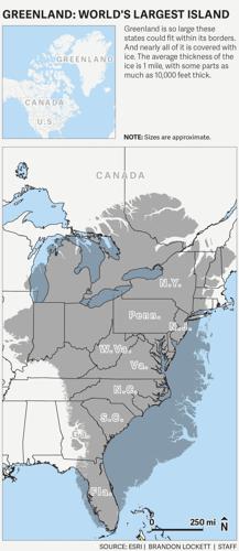
So many things in Greenland are gigantic. Greenland is five times the size of California, and roughly 80 percent is covered with ice. Greenland's ice sheet is a mile deep on average, but near the center of the country it rises 10,000 feet into the sky. Greenland's ice sheet is so thick and heavy that it makes the Earth wobble a bit as it spins, like an unbalanced top. When the ice sheet meets the ocean, the ice sometimes cracks and falls with the force of atomic bombs. Even Greenland’s language, Greenlandic, has huge words — one is 153 letters long.
Greenland’s ice is melting in a big way, too. This summer, so much melted in one week that you could flood the entire state of South Carolina with 2 feet of water. The ice sheet normally melts in the summer, but it’s melting faster now than it has in 12,000 years.
All this melting ice raised sea levels across the globe, just as dropping ice cubes into a whisky drink eventually makes a mess. Except some ice cubes in Greenland can be half the size of Manhattan.
There’s more: The Greenland ice sheet is so massive that it generates its own gravity. It pulls the Atlantic Ocean toward it like someone tugging a blanket. South Carolina is at the other end of this blanket, which means that Greenland pulls water away from our coast, lowering our sea level. But as the ice melts, its gravity disperses and its grip loosens. Seas at the far end of the ice’s power slosh back.
That’s one reason sea levels in South Carolina have risen faster than many other places around the globe.
Greenland is 3,000 miles north of Charleston, but this distant land of ice, polar bears and reindeer already has reshaped our coastline. It has made Charleston's tides higher, our flooding worse. And what happens in Greenland in the future will largely determine the Lowcountry's fate.
These forces come with overwhelming numbers, so it’s best to start smaller. Perhaps by flying in a 78-year-old plane over the world’s fastest-moving glacier.
With an Elvis impersonator on board.

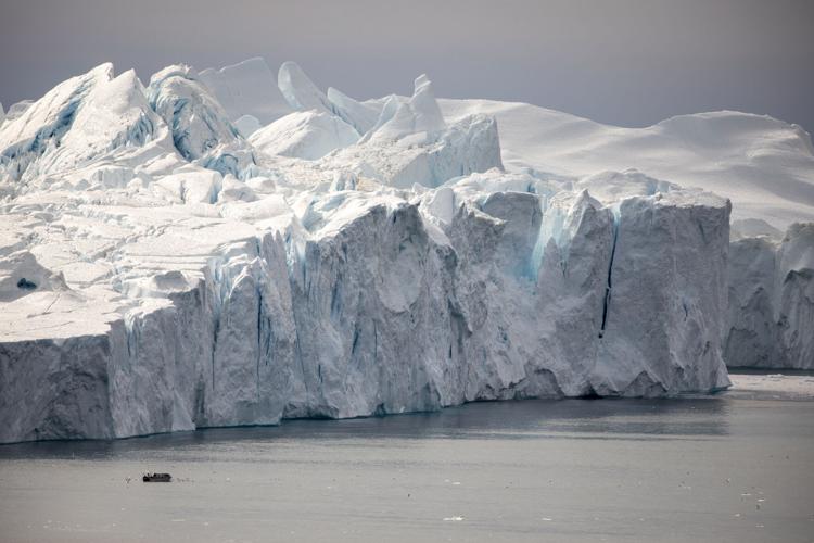
Icebergs dwarf a fishing boat in Disko Bay outside of Ilulissat on Aug. 10, 2021. The giant ice sculptures are pieces that have broken off Ilulissat Glacier, also known as Jakobshavn, 40 miles inland. Lauren Petracca/Staff
2. The ice has left the building
It was the middle of August, and the afternoon temperature was in the low 60s, speeding up the summer melt. Above western Greenland, Josh Willis crouched in the back of a World War II-era DC-3.
He wore a blue NASA jumpsuit and cradled a 3-foot-long metal tube. He peeled off a sticker that said “REMOVE BEFORE LAUNCHING.” Setting the tube down, he opened a round metal hatch in the floor. Through the hole, you could see the Ilulissat Icefjord below.
Willis has a cherubic face and those long Elvis sideburns. Mention that he looks like Elvis and he lowers his voice and answers with the King's trademark, “Thank you very much.” He’s a graduate of Second City’s comedy school in Los Angeles and has done shows on Hollywood Boulevard. His performances are a bit of oil and water — climate science and comedy. But he thinks that scientists could do a better job talking about their discoveries, and humor helps. For a science communication contest a few years ago, he and friends did a music video called the Climate Rock. In it, an 11-year-old asks, “What is climate?” Willis, in a 1970s Elvis jumpsuit, sings:
“You take a bunch of weather and you average it together and you’re doing the Climate Rock!”
Climate Elvis was born.
Willis has a more serious day job: climate scientist with NASA’s Jet Propulsion Laboratory in Pasadena, Calif. He leads the agency’s OMG project, which does not stand for “Oh My God,” though Willis does find himself saying that when he looks below and sees Greenland’s cathedrals of ice. It stands for Oceans Melting Greenland, a title he cooked up a decade ago as a catchy way to describe the project’s central question: Do warming oceans affect Greenland’s ice sheet?
Which is how he ended up throwing things out of airplanes.

Mike Wood, a post-doctoral researcher at NASA’s Jet Propulsion Laboratory (left) and Josh Willis, who leads the agency’s OMG project, short for Oceans Melting Greenland, watch a computer screen for data sent up from a probe while flying around the coast of Greenland on Aug. 14, 2021. The project is researching how warming waters impact ice melt. Lauren Petracca/Staff
•••
The Ilulissat Glacier is a key OMG target and one the most important glaciers you’ve probably never heard of. It pours into a large valley near the town of Ilulissat, which is pronounced illoo-lih-sat and means “icebergs” in Greenlandic. The glacier also goes by other names: Jakobshavn, after a Danish merchant, and still used by many scientists; and the Greenlandic name “Sermeq Kujalleq,” or south glacier. But given all the giant icebergs, Ilulissat fits best.
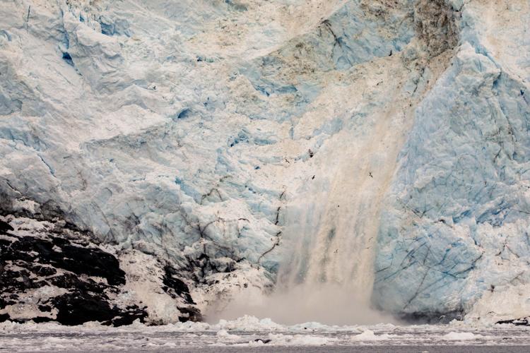
About 40 miles from the sea, the Ilulissat Glacier forms an 8-mile wall called a calving front. Here, ice moves toward the ocean at 150 feet per day — a pace that tripled during the 1990s and 2000s. As it moves, it creates a great white shelf over the water that breaks off, often violently.
On warm days, the ice cracks like cubes after they’ve been dropped in a warm drink, except these cracks sound like thunderclaps and shake your ribs. Chunks as large as skyscrapers crash into the water, launching ice shards and spray. Some fractures release so much energy that geologists call them glacial quakes. Earthquake instruments across the world detect the biggest calving events. In 2008, a crew for the documentary "Chasing Ice" watched part of the ice wall collapse in a roar of thunder and white. The chunk was larger than 3,000 Egyptian pyramids.
All this falling ice flows down a fjord that’s 2,500 feet deep. But near the fjord’s mouth, the biggest icebergs hit an underwater speed bump — a sudden rise in the seabed that’s still about 800 feet deep. This bump creates the world’s most beautiful traffic jam.
Icebergs with giant arches crowd ones that look like snow cones, alligator heads and cowboy hats. Blue meltwater rivers speed down shimmering white slopes. Humpback whales swim between iceberg cliffs. Water streams off the cliffs, sounding like a steady rain. Some icebergs lose their balance as they melt. Without warning, they do summersaults, even ones as large as aircraft carriers. This can swamp fishing boats and smear the water with white ice bits for miles.
Over time, ice melts below the big icebergs, enough to clear that 800-foot-deep speed bump. Freed from the fjord, they float into the open ocean, propelled now by powerful currents.
But this traffic jam had long given OMG fits. The NASA crew needed space in the water to drop their probes, and sometimes the bergs were bumper to bumper. A few days before, they’d found an opening to drop a probe. But it didn't broadcast any data. Now they were back for another try.
And Willis badly wanted the measurements, in part because of what they’d discovered a few years before.

A 1942-era DC-3, carrying NASA scientists studying water temperature and salinity, flies over the Ilulissat glacier on Aug. 14, 2021. Lauren Petracca/Staff
•••
The probes do two simple things: measure water temperature and saltiness. But they do this in a complex way: After Willis pushes the tube down the chute, a parachute opens, slowing the probe to about 60 mph before it hits the water. A battery that uses saltwater to generate a charge then triggers a second probe.
Tethered by an unspooling wire, the second part sinks toward the seabed, beaming up data to the plane. Satellites and aerial surveys can’t measure temperature and salinity deep in the sea, Willis explained. “So you have to put a thermometer in it.” And they need to do this from a plane because of Greenland’s size — nearly 1,700 miles from its northern tip to its southern, or roughly the distance between Charleston and Denver.
The OMG flights began in 2016. Flying low, they dropped about 250 probes around the entire country that year. Almost immediately, they stumbled on something unexpected.
The Ilulissat Glacier was growing.
This was surprising because Ilulissat is known in scientific circles as a global floodgate. Floodgates are massive faucets that drain the ice sheet, and Ilulissat’s melt is so formidable it may have already contributed more to sea rise than any other single feature north of Antarctica.
But the OMG data showed it was expanding for the first time in 20 years.
“At first blush, it seemed like great news,” Willis said.
It wasn’t.
More readings showed that a large blob of cold water had moved into the fjord, temporarily cooling the glacier like a big ice blanket. This allowed the ice above and below to grow. The glacier expanded again in 2017, 2018 and 2019.
But in 2020, the cold water left the fjord. Warm water replaced it, and the glacier shrank. Bad news for places like Charleston, New Orleans and other cities at or near sea level.
For the OMG scientists, “it was a home run,” Willis said.
It proved their hypothesis: What's happening hidden below the waves affected when and how glaciers melted. And it showed that the warming waters of the Atlantic and its undulating currents drove that melt.
Based on this OMG work, scientists were able to calculate that Greenland’s already major contribution to sea rise might be twice as large as previously thought.
As Willis readied the probe, summer heat waves had smashed records in the western United States and Europe. Willis wondered: Was the water in the Ilulissat Icefjord still getting warmer?
Video: The Greenland Connection
Josh Willis, a climate scientist with NASA's Jet Propulsion Laboratory and the head of the Oceans Melting Greenland project, discusses what is happening in Greenland and the impacts it has on sea level rise. Lauren Petracca/Staff.
STORY CONTINUED BELOW
•••
In the cockpit, a Canadian pilot named Jim Haffey saw a few openings in the ice floe.
“This could work,” he said, motioning to a patch about the size of a basketball court.
“I like it,” said Mike Wood, a post-doctoral researcher at NASA’s Jet Propulsion Laboratory.
“Let’s give it a shot,” Willis said, loading the probe into the chute.
The old plane dove. The icebergs grew larger. The altimeter ticked below 700 feet.
600.
500.
“Now!” the pilot said.
“Twelve away,” Willis said, pushing the probe down the chute.
The pilot banked left hard, looking for the probe’s splash.
In the back, Willis and Wood waited for a signal.

In downtown Charleston, Tonya O’Neal wades through floodwaters following a heavy rain to get back home after leaving Green’s Grocery on Bogard Street on June 13, 2021. Lauren Petracca/Staff
3. Signal
That same weekend, 3,000 miles south, Hurricane Grace cartwheeled toward Veracruz, Mexico — the strongest hurricane ever recorded in that region. Tropical Storm Fred pounded the Florida Panhandle, flooding areas with 7 to 9 inches of rain as it moved inland toward the Carolinas. Henri formed off the East Coast, beginning its destructive trek to Rhode Island.
You can’t pin climate change as the cause of these storms, but physics and patterns signal whether they're getting worse.
Heat-trapping carbon dioxide levels in the atmosphere haven't been this high for 4 million years, an increase due largely to the burning of coal, gas and other fossil fuels. The average global temperature has risen 1.8 degrees Fahrenheit since 1975, and physicists know that every increase like that means the air can hold 7 percent more moisture. Put another way: In a warming world, the buckets above our heads get larger.
At the same time, ocean temperatures are rising, up 1.5 degrees since 1901. Warmer water naturally expands. And more volume means higher sea levels, more record-breaking floods. Where Charleston typically saw one or two tidal floods a few decades ago, last year we had 68. And that followed 2019's all-time record of 89. It also means more water in people's homes and yards, even when it's sunny.
And all this warmer air and water fuels more intense storms, research shows. Hurricanes are intensifying more rapidly; they’re forming earlier in the season; they’re dumping more rain. Last year, the overheated waters of the Atlantic spawned a record 30 storms, so many that forecasters began using Greek letters to name storms.
In the Southeast, this extra heat translates into a 27 percent increase in torrential rainstorms — summertime downpours like one that would soon hit North Charleston.

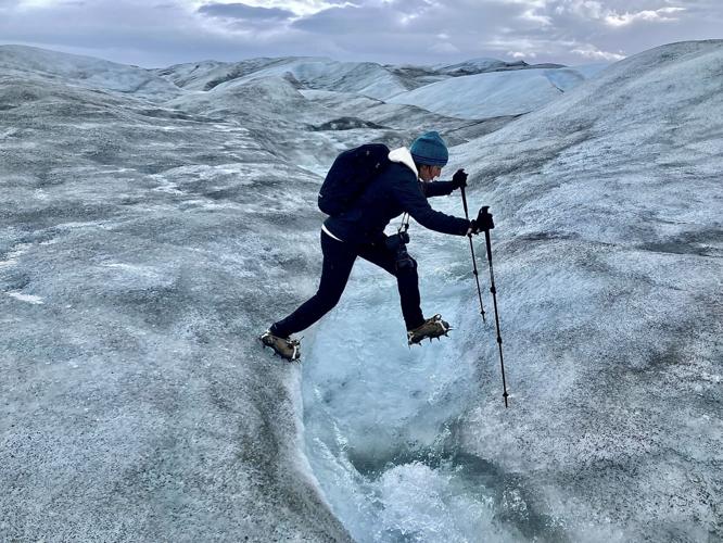
Adam Lyberth maneuvers through blue-and-white hills of ice and snow on the Greenland ice sheet on Aug. 13, 2021. An Inuit shaman, he says he’s walked on the ice more than 3,000 times, and that it changes every day. Lauren Petracca/Staff
4. Heart
But before that happens, let’s get out of the sweatbox, head back to the Arctic, where flying over the Greenland ice sheet is one way to get a sense of things. Another way is to go even smaller. Put boots with metal crampons onto the ice sheet itself as it melts, hear the clomp, clomp, clomp of your guide, Adam Lyberth, as he steps toward the edge of a blue-and-white chasm that could be your last memory if you slip.
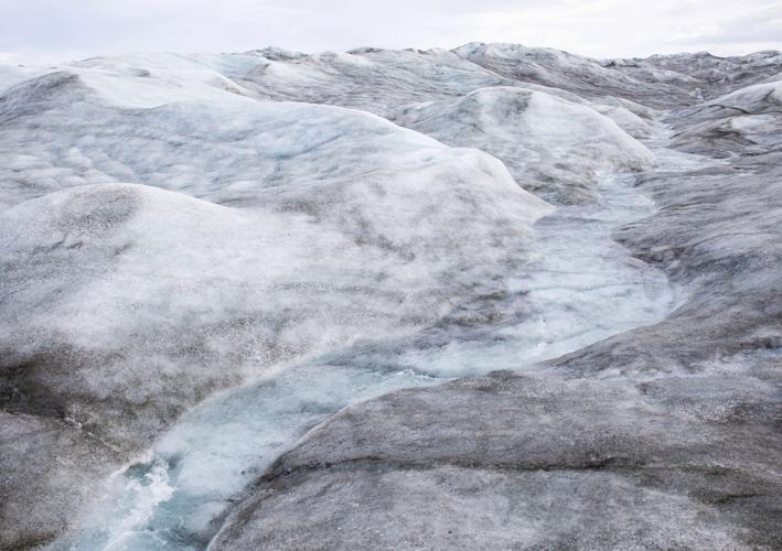
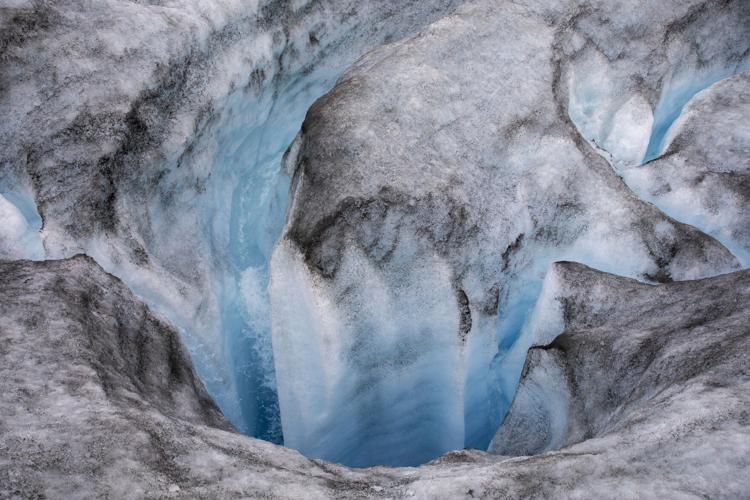
The ice itself is hard but soppy. Walking on it, you see more small cracks than you might expect. But it’s the blue hues around you that grab the eyes. Set against the white, the blues are so vibrant they seem at once pure and fake. The scientists who dreamed up toilet bowl cleaners nailed the same tint.
Bubbles in ice make it white. When layers of snow pile up over centuries, those bubbles get squeezed out, and the ice takes on a sapphire shade. This blue ice is denser and safer to walk on. You also see this color in meltwater lakes and streams. The streams curl through the pack. They pour into fissures that drop for hundreds of feet. Gurgling streams rush under ice bridges. They carve deep canyons over time, making formations like those in southern Utah — except everything here is wet, and white and blue with streaks of black. You can’t feel it, but all that water and ice under you is moving toward the ocean.
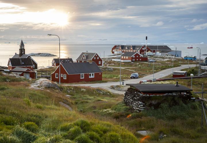
Lyberth, an Inuit shaman, took in the spectacular view and meditated on the changes he’s seen in his country.
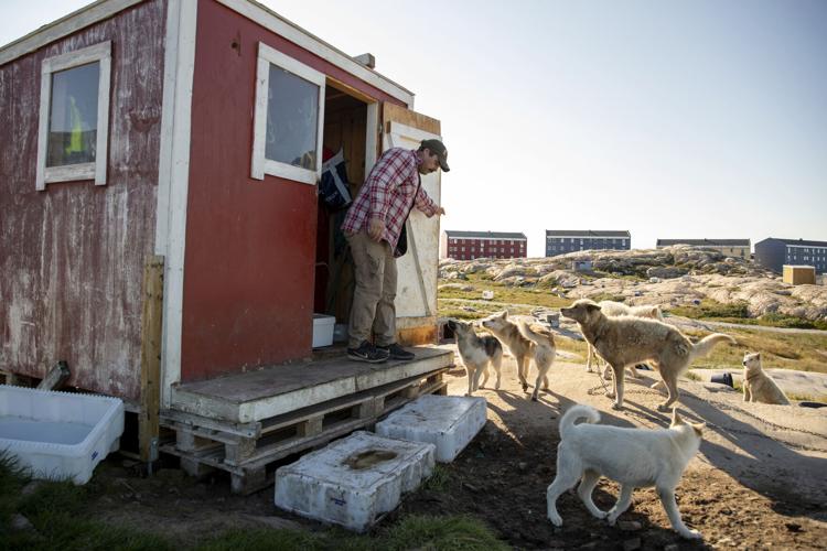
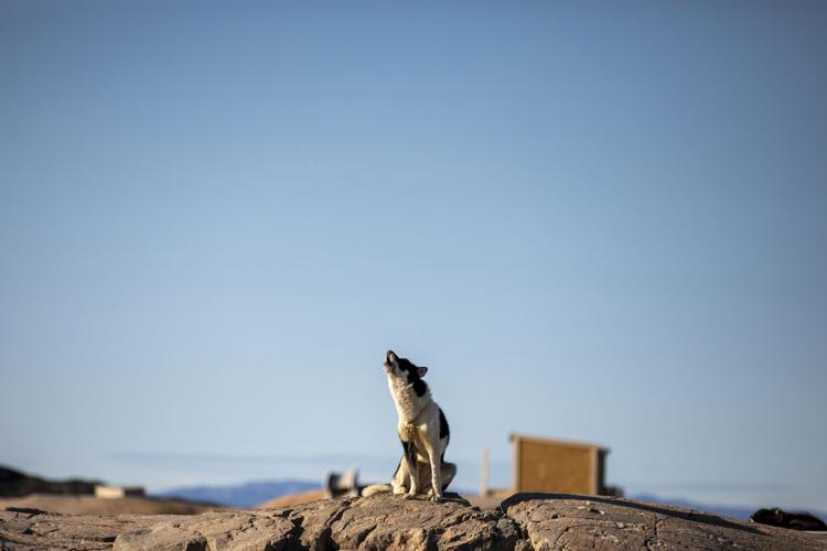
Just 56,000 people live in Greenland, a few thousand more than the Charleston suburb of Summerville. In some towns, sled dogs outnumber residents. Lyberth grew up in one of the small settlements that cling to the coast in Western Greenland, not far from the town of Kangerlussuaq. Now, a day before his 60th birthday, he said his present was "to be here on the big ice.” He said he’s visited the big ice at least 3,000 times, mainly as a guide for tourists and European royalty, taking them to places “where if you fall …” He paused and waved bye-bye with his hands.
Lyberth is a thoughtful man, and as a shaman elder, he said he’s experienced nature in ways that may seem foreign even to other native Greenlanders; he sometimes sees shades of light move past his field of vision that portend calamities. He can do an impressive musk ox call. Nature helps connect our minds with our hearts, he said. But over the decades, he’s witnessed a disconnect in the nature around him, the kinds of changes that Willis and Wood from NASA and so many other scientists are trying to measure.

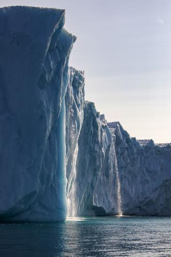
Meltwater pours off the sides of an iceberg in the Ilulissat ice fjord, creating streams that sound like a drenching rain on Aug. 9, 2021. Lauren Petracca/Staff
Along the ice sheet’s edges, there's land where giant ice walls rose a few years ago. The ice that’s left melts faster, and it’s dirtier, Lyberth said. Some of it is wind-borne dust left by melting glaciers. And some is black carbon, the soot-like specks from distant wildfires, vehicle tailpipes, coal plants, even micro-particles from tires as they wear down. These dark particles absorb more heat than white snow. The evidence was by his feet. Small-bore holes — places where dark specks landed and melted into the ice.
It’s warmer, he said. Much warmer. Winter temperatures rose 8 degrees during the past 30 years, and summer temperatures are 3 degrees higher. Warmer weather thawed the permafrost, making buildings from Greenland to Alaska sink and tilt. Melting ice exposes land that had been covered for thousands of years, releasing gases that remind him of a pig farm. And Greenland usually gets relatively little snow and rain, Lyberth added. But warmer air holds more moisture.
“The rain falls harder now.”
While he stood on the lip of the ice canyon, the sun suddenly broke through the rain clouds. The ice sheet sparkled for a moment. The meltwater gave everything a watery sheen.
There, on the edge, Lyberth also thought about all the wildfires this summer in Europe and the United States, the record-breaking heat waves, the changes in the Arctic. He thought about how they were spiritual warnings as much as climactic ones.
“I think the heart of man has melted.”

In the South Carolina Lowcountry, the tide washes over trees at Botany Bay Plantation Heritage Preserve September 9, 2021. Archaeologists are racing to study nearby shell rings threatened by rising seas. Lauren Petracca/Staff
5. Downpour
It’s easy to think you’re melting in South Carolina during the middle of summer. On Aug. 15, the air was heavy and wet. Weather balloons launched by the Charleston International Airport recorded enormous amounts of water overhead; the buckets were full, and it wouldn’t take much to tip them over.
The Lowcountry is well-named, with much of the land just a few feet above sea level. This makes it vulnerable to threats from above and below. Seas rose about 1.4 inches in the 1990s. But then the pace accelerated, up 2 inches in the 2000s, 2.7 inches in the 2010s. Now, it’s on pace to rise more than 3 inches this decade, and the pace only speeds up after that.
A few inches might not seem like an emergency, but in the Lowcountry, every inch counts. More and more, floods pour into streets at high tide. High water hems cars into driveways, making them unusable in emergencies. Longtime downtown residents, including some in their 70s, drag metal barricades across streets to prevent motorists from plowing down flooded streets. Emergency vehicles take detours on the way to downtown Charleston’s hospitals. Beaches are eroding more quickly; flood insurance rates are rising.
A recent College of Charleston study found a 1-foot increase means about one-fourth of Charleston County will see regular flooding, affecting at least 1,000 homes and other buildings.
And when water from above meets rising water below, we get squeezed even more — as happened when the rain began to fall that Sunday over North Charleston.


Seagulls fly around an iceberg in Disko Bay outside Ilulissat on Aug. 4, 2021. Pieces of ice the size of islands break off the Ilulissat Glacier 40 miles inland, forming a long parade of icebergs as they flow out to sea. Lauren Petracca/Staff
6. Fingerprints
High above Greenland, with the NASA crews, the ice sheet looks like a vast flat Sahara.
And standing on the ice with an Inuit shaman reveals its more complex contours.
But what’s all this have to do with us?
Here, it’s best to step back again from Greenland for a moment and think about bathtubs.
For many years, scientists assumed that just like turning on a faucet raises the water level in a tub, melting ice in Greenland and Antarctica raised sea levels uniformly across the globe. Scientists predictably called this “the bathtub model.”
But the bathtub model never explained why some places, including the Southeast and Gulf coasts, had higher rates of sea rise than others. Subsidence and the lingering effects of the Ice Age partly explained these differences: Some areas naturally sink as Earth’s tectonic plates move about. But when scientists factored out subsidence and the Ice Age, some coastlines still had higher rates.
Then, in the late 1990s, a team led by a scientist named Jerry Mitrovica began thinking hard about Greenland’s huge ice sheet. As physicists, they knew Greenland’s ice locked up gravity. And gravity’s ability to move the seas was as obvious as a high tide. Greenland’s heavy ice sheet also must pull the ocean toward it, like a miniature moon, they thought. Like an incoming lunar tide, this should raise sea levels near Greenland.
But on distant shorelines, this gravitational force would do something else: pull water away from coastlines, lowering their sea levels like an outgoing tide.

Mitrovica and his colleagues wondered: What if the Greenland ice sheet melted?
So, using computer models, they filled the bathtub, simulating what would happen if enough ice in Greenland melted to raise global sea levels 1 meter (just over 3 feet). Then, taking changes in gravity into account, they mapped the results.
“That was the eureka moment,” Mitrovica said, now at Harvard.
There, in red and blue hues, were Greenland’s long gravity fingerprints. Closer to Greenland, with less gravity from the ice sheet, sea levels went down. But at about the 1,200-mile mark, seas rose as the oceans surged back.
At the time, Mitrovica tried to explain these counterintuitive findings to a group in the Netherlands.
“They practically ushered me out of the room, thinking I was a lunatic.”
But their work would provide the foundation for our understanding of a key but underappreciated force that affects hundreds of millions of coastal residents. And, more recently, NASA scientists took the gravity fingerprint concept a step further.
They looked at which areas of melting ice in the world affected which seaside cities the most, including Charleston. In other words, how much did ice loss in Greenland affect Charleston versus glaciers in Alaska or Antarctica?
The results showed that Greenland’s melting ice had by far the biggest gravitational impact on Charleston’s sea level – more than Antarctica and much more than all the world’s melting mountain glaciers.
It showed that gravitational losses in Earth’s ice during the next 10 years would add half an inch of sea rise here, with 40 percent of it coming from Greenland.
And Western Greenland was Charleston’s gravity-loss hotspot, namely the area around the Ilulissat Icefjord.
The floodgate.
The place Climate Elvis was trying to probe.
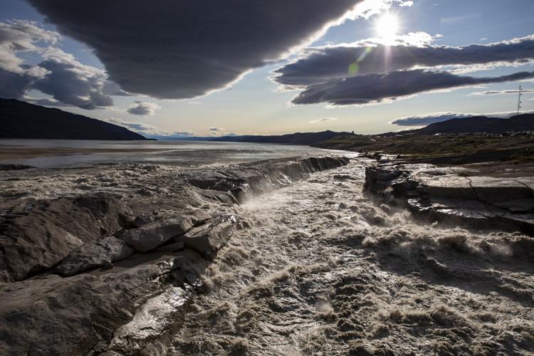
Meltwater from the Greenland ice cap rages downriver in the town of Kangerlussuaq on Monday, August 16, 2021. Since 1992, nearly 5 trillion tons of Greenland ice have entered the ocean, raising sea levels about half an inch globally. Lauren Petracca/Staff
7. Melt
The old DC-3's two propellers groaned as the plane circled above the Ilulissat Glacier. The mile-thick ice hides a feature that worries scientists like Willis. Underneath, water extends another 189 miles into the belly of the ice dome. In other words, if the ice sheet was a bottle, the Ilulissat Glacier would form the neck. And that bottle will drain faster with warmer water below and warmer above.
“The cork is out of the bottle,” Willis said.
A very large bottle.
Greenland’s ice dome locks up a huge amount of freshwater, roughly as much as all the rivers and lakes in the Northern Hemisphere combined, including the Great Lakes — half of the freshwater this side of the equator. But Greenland’s glaciers are melting six to seven times faster today than 25 years ago, with upward of 5 trillion tons of ice going into the oceans since then.
That’s enough to cover the entire United States with nearly 2 feet of ice. That melted ice alone raised seas by nearly half an inch. That doesn’t sound like much, but scientists estimate that every half inch of sea rise means 6 million additional people around the world experience regular floods — a situation that residents in low-lying areas of Charleston, Miami, Norfolk, Va., and other coastal cities know only too well.
Some of this meltwater also poured into a conveyer belt of ocean currents that scientists call the AMOC, short for Atlantic Meridional Overturning Circulation. The powerful Gulf Stream is part of this conveyor belt. It flows past the East Coast with so much force it pulls water away from our beaches like a centrifuge. Without it, our sea level would be 3 feet higher.
But Greenland’s massive ice melt has tossed a giant wrench into this important system. In 2009, when the AMOC slowed, sea levels in New England suddenly rose 5 inches for about a year. Scientists say the AMOC system has slowed by 15 percent, and by some measures is at its weakest point in 1,600 years.
“The gravity issue may represent a small increase in Charleston’s sea level, let’s say 20 percent, and ocean currents might be another 20 percent, and thermal expansion (of the oceans) another 20 percent, but once you add up these and other 20 percents out there, you have a problem,” Willis said.

Greenland is a magnet for scientists trying to understand climate change, and with its spectacular icebergs, it's also attracting more and more tourists. A tour guide holds up a piece of ice for visitors while sailing around icebergs in Disko Bay on Aug. 4, 2021. Lauren Petracca/Staff
•••
Manning the monitors, Mike Wood heard the probe’s signal, which sounded like an old fax modem. Was there enough saltwater to trigger the battery? The weather had been unusually warm, and it had been raining, as well. A few minutes passed. The pilot circled. No data. Another dud.
“Jakobshavn is being complicated this year,” Wood said, referring to the Ilulissat Glacier’s Danish name.
“Jakobshavn is being a jerk,” Willis said.
Greenland is gigantic, and so are the forces melting its ice, staggering at times. As a scientist, how do you navigate the winds of doom that howl through climate journals? The numbing data? The frustration over fixed beliefs that prevent action? The troublesome experiments like today’s?
“I gravitate toward comedy because it’s what I like,” Willis said. “But I also wanted to do comedy about climate science because I think it opens a door when you share a laugh together.”
Laughing together makes it harder for people to treat each other like enemies, he said. It melts our hearts for a moment, but in a good way.
A few minutes later, they launch a second probe. And a third. Both duds. Just too much freshwater.
But three weeks later, they went back for one more try. This time, the probe worked. Willis and his colleagues will now crunch the numbers — possibly for the last time.
NASA originally designed and funded OMG as a five-year experiment. The agency extended it a year, in part because of its findings last year that the Ilulissat floodgate was open again.
The DC-3 headed back to the landing strip, crossing over the ice sheet. It was cloudy, which helped bring out the blues in the meltwater lakes and rivers flowing toward the coast.
“After OMG ends, Climate Elvis will be available for weddings and parties,” Willis joked.

Josh Willis, a NASA climate scientist, watches through the window for a probe he dropped from a plane into the Ilulissat Icefjord Aug. 14, 2021. Willis says Greenland is shedding ice more than seven times faster than in the 1990s. Lauren Petracca/Staff
•••
Some hours later, a different kind of floodgate opened over North Charleston. The rain began to fall, and then it came down harder. At the Charleston International Airport, about 2.8 inches fell in a single hour. More than 3.8 inches fell at the Goose Creek Reservoir. Forecasters issued flood advisories. Water filled the streets and began to pool.
Another drenching rain. Another record for the day — 4.1 inches, besting one set in 1971.
It was nothing, though, compared to what happened farther north.

There, on Greenland’s great ice sheet, three times the size of Texas, at the very top of its 10,000-foot ice dome, a science station’s thermometer went above freezing. Until recent years, this had happened just six times in the past 2,000 years, ice core records showed. In the past decade, it already went above freezing twice, and this marked the third time.
Even so, the station had never recorded any rain, only snow.
But that day, for the first time, it didn’t just rain. It came down hard. Like a Lowcountry storm.

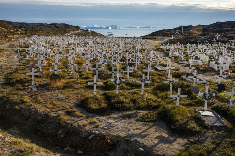
A cemetery above Ilulissat frames a view of Disko Bay as giant icebergs float out to sea on Aug. 9, 2021. A Greenlandic tradition is to bury loved ones in places with beautiful views and close to hunting grounds. Lauren Petracca/Staff
Acknowledgements and about the story

Lauren Petracca reporting for The Greenland Connection project while hiking on the ice sheet near Kangerlussuaq, Greenland, August 2021. Tony Bartelme
So many things about Greenland are big — except for its population. Just 56,000 people live here, and most towns are reachable only by boat or plane — transportation that generates a large carbon footprint. We offset this project with carbon purchases from Terrapass, which funds projects to reduce C02 emissions around the world.

Tony Bartelme on NASA plane while reporting for The Greenland Connection climate project. Lauren Petracca
In Greenland, we navigated iceberg-flecked waters and fought off a suicidal drone with Claus Foss Hansen, who operates WhaleTours in Ilulissat. Karen Buus and Arne G. Petersen of AirZafari showed us Greenland from above. Ringo Mathiassen, a fisherman in Ilulissat, showed us his sled dogs and helped us understand how climate change affects people in the Arctic. Jim Haffey of Kenn Borek Air gave us an incredibly thorough briefing before our flight with NASA scientists. ("If the plane crashes and everyone is unconscious, here's how you turn off the engines.")
What is the single most important contributor to rising seas in Charleston? A. "Too many buildings?" B. "Too many people at the beach?" or C. "Greenland?"
In addition to the scientists quoted in the story, we interviewed more than a dozen other researchers. Special thanks to Eric Rignot, Eric Larour, Mike Wood and Jane Lee at NASA, Natalya Gomez from McGill University in Canada. Christian Rodehacke of the Danish Meteorological Institute helped with melting calculations. And Susan Joy Hassol helped connect us with key researchers in the project's early stages.

Charleston residents have more in common with Greenlanders than you might think. Sure, our coastline has sand and palm trees, while the Arctic coast is speckled with giant icebergs. But our ways of life are dependent on many of the same things.


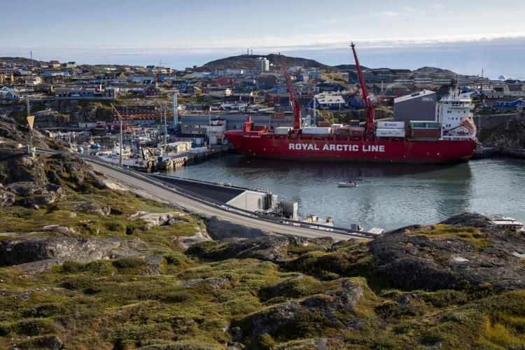


Photos: Daily life in Greenland
Daily life among the ice in Greenland in August 2021.
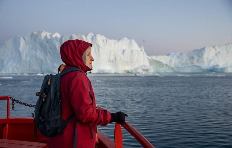
Kristina Kilman, a geology teacher from Sweden, looks out at icebergs from a tour boat in Ilulissat, Greenland on Wednesday, August 4, 2021. Kilman believes it is important to teach her high school students about climate change. “You can’t go on pretending like it’s not dangerous,” she said. Lauren Petracca/Staff


