Home »

High snowpack levels carry flood concerns
East Kootenay snowpack 115% above normal
 A long snowy winter is reaching its zenith and with the melt comes renewed concerns of flooding in the East Kootenay.
“Overall, the province has a slightly-above normal snow pack for February 1, with the average of all snow measurements across the province at 108%, increasing significantly from 96% of normal on January 1,” the BC River Forecast Centre (BCRFC) noted in a recent report.
“Well-above normal snow pack (>130%) is present in the Okanagan, Similkameen, Lower Fraser, South Coast, Skagit and Vancouver Island. Above normal snow pack (110- 120%) is present in the East Kootenay, West Kootenay and Boundary regions. Near normal snowpacks (80-110%) are present throughout the rest of the province. The Fraser River snow index as an entire watershed is 101% of normal,” the BCRFC outlined.
Over the past six weeks weather patterns have aligned with typical La Niña weather, bringing significant growth to the provincial snow pack, the report added.
For those hoping Old Man Winter is packing his things to make room for spring, the BCRFC report won’t be good news.
“Seasonal forecasts (February to April) from Environment and Climate Change Canada are indicating an increased likelihood of normal temperatures across western and southern British Columbia and below normal temperatures in south-east and northern B.C. Short-to-medium term forecasts are suggesting near normal temperatures through February,” it notes.
By early February, nearly two-thirds of the annual B.C. snowpack has typically accumulated.

The provincial government is keeping a close eye on conditions, noted Jennifer Rice, Parliamentary Secretary for Emergency Preparedness in a March 14 op-ed piece (to accompany this story), titled ‘Higher-than-usual snowpack heightens flood risk.’
“Changing temperatures, melting snow and higher-than-normal precipitation all contribute to the threat of landslides and flooding, especially when high temperatures converge with significant rainfall and rapid snowmelt. This is a situation that created challenges for much of the Interior last spring,” she said.
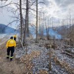
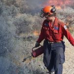
“While a high snowpack does not necessarily lead to a particularly active flood year, it’s been a long, cold winter, and the River Forecast Centre is keeping a close watch on snow melt and water levels. Wildfire sites in the Cariboo, Central and Southeast regions of the province have been evaluated for potential hazards. This is because wildfire-charred landscapes may lead to increased run-off and put homes at risk from flooding or landslides.”
Rice said the Ministry of Forests, Lands, Natural Resource Operations and Rural Development is reviewing mitigation proposals for construction of protective earthen berms, creek channelization or debris retention basins, and ensuring bridges and culverts are ready.
And Emergency Management BC is committed to improving the public safety of all British Columbians.
“That is why we are investing heavily in flood prevention and protection,” she said.
Lead image: Mark Creek, Kimberley on March 13. e-KNOW photo
e-KNOW