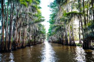
Wetland Loss Weakens Natural Storm Buffers in Coastal Louisiana
Earl Carr, Jr., president of Gulf 52 in Hammond, Louisiana, emphasized that the degradation of coastal wetlands is not simply an environmental issue but a long-term risk to public safety and regional resilience. "Understanding the science behind wetland loss is essential to making informed decisions about land use, development, and disaster mitigation in Louisiana’s most storm-prone areas," Carr, Jr. noted.
The Role of Wetlands in Storm Protection
Wetlands—particularly marshes, swamps, and barrier islands—function as natural shock absorbers. When storm surge pushes inland, these landscapes slow the water’s advance by providing friction and absorbing wave energy. The complex root systems of wetland vegetation help hold soil in place and reduce erosion, while also trapping sediment and storm debris.
Research indicates that every 2.7 miles of healthy wetlands can reduce storm surge height by approximately one foot. In a region where hurricane-driven water can reach 10 feet or more, even small reductions can mean the difference between minor flooding and catastrophic loss.
In addition to surge protection, wetlands help manage rainfall. These saturated environments store large volumes of water, mitigating flash flooding during and after storms.
Causes of Wetland Loss in Louisiana
Louisiana has lost more than 1,800 square miles of wetlands since the 1930s, with ongoing losses continuing to reshape the coastline. Several interrelated causes contribute to this decline:
Canal Construction: Navigation and oil field access canals cut into marshes and allow saltwater intrusion, which kills off freshwater vegetation and weakens root structures.
Levee Systems: While protecting communities from river flooding, levees prevent sediment-rich waters from replenishing wetlands during spring floods. Without sediment deposits, marshes subside and drown.
Subsidence: Louisiana’s coastal zone is naturally sinking due to compaction of delta sediments. This process, combined with sea-level rise, leads to open water replacing formerly vegetated areas.
Sea-Level Rise: Higher sea levels result in deeper water in marsh zones, making it harder for native plants to survive and trapping less sediment.
Storm Damage: Hurricanes and tropical storms, while buffered in part by wetlands, can also cause direct erosion. Without recovery time between storm seasons, these losses become permanent.
Consequences of Diminished Storm Buffering
As wetlands shrink, inland areas become increasingly exposed to storm impacts. Storm surge travels farther and reaches higher elevations. Floodwater recedes more slowly. Coastal communities lose their natural defenses, placing greater strain on engineered infrastructure like levees, pumps, and floodgates.
Critical assets—ports, chemical plants, highways, and pipelines—are at heightened risk when the natural barrier between them and the Gulf weakens. Emergency response becomes more difficult, evacuation routes become compromised, and insurance costs rise.
Loss of wetlands also affects ecosystems that support fisheries and wildlife. The disappearance of marshland reduces nursery habitat for shrimp, crab, and many commercially important fish species.
Scientific Monitoring and Modeling
Tracking wetland loss and predicting future trends relies heavily on satellite imagery, aerial surveys, and hydrologic modeling. The U.S. Geological Survey (USGS), Louisiana Coastal Protection and Restoration Authority (CPRA), and university research teams regularly assess coastal land change using high-resolution mapping.
Advanced modeling tools simulate how marshes interact with tides, storms, and human development. These models are used to evaluate how restoration projects or policy changes could alter future land loss trajectories. Data from these tools inform large-scale restoration efforts, which may include sediment diversions, marsh creation, and ridge restoration.
Restoration Efforts and Limitations
While restoration projects are underway across coastal Louisiana, the scale of loss often outpaces recovery. Sediment diversions aim to reintroduce river water into the marsh to mimic natural land-building processes. Dredging projects build new marsh platforms with sediment from offshore or river sources. These projects take time and face environmental, political, and financial challenges.
Barrier island reinforcement and mangrove planting provide additional protective layers, but success depends on maintenance and monitoring. Without sustained investment, even restored areas can degrade again under pressure from storms and rising seas.
A Broader Resilience Strategy
Reducing storm risk in Louisiana must go beyond concrete levees and flood walls. Wetlands, when preserved and restored, offer a cost-effective and sustainable solution that works in tandem with built infrastructure. Protection of remaining wetlands, strategic restoration of degraded areas, and coordinated planning across agencies all play a role in building a more resilient coastal system.
As development continues to press into vulnerable zones, integrating ecological function into planning is critical. Wetlands are not just scenery—they are functional, protective, and measurable assets in the fight against coastal disaster.
According to Earl Carr, Jr., recognizing the value of wetlands for what they are—a living, evolving layer of defense—is necessary for the future of Louisiana’s communities.
Morgan Thomas
Rhino Digital, LLC
+1 504-875-5036
email us here
Visit us on social media:
Facebook
Distribution channels: Building & Construction Industry, Environment, Real Estate & Property Management
Legal Disclaimer:
EIN Presswire provides this news content "as is" without warranty of any kind. We do not accept any responsibility or liability for the accuracy, content, images, videos, licenses, completeness, legality, or reliability of the information contained in this article. If you have any complaints or copyright issues related to this article, kindly contact the author above.
Submit your press release

